Max Bahar
About

I'm a Data Science Master's student at Harvard with 3+ years of experience in geospatial analytics and machine learning. I specialize in mapping tools and data visualization, helping organizations turn complex datasets into actionable insights.
Previously, I was an Analyst at Caliper, where I partnered with Fortune 500 clients to integrate mapping software into business workflows, tailoring our tools to each organization's needs.
I'm passionate about applying data-driven platforms - from GIS systems to machine learning models - to solve impactful, real-world challenges.
Featured Work
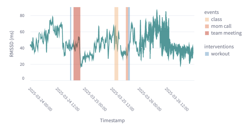
From Wearable Data to Actionable Stress Insights
May 2025Built an interactive visualization tool combining wearable signals with user context to reveal stress patterns and guide better interventions.
Check out the repository for more details on the data visualization platform.
 Python
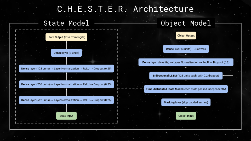
Space Object Identification with Neural Networks
May 2025Developed a neural network model (Contextual History-based Evaluation of Space Trajectories for Entity Recognition or CHESTER) to classify space objects by orbital patterns, integrating temporal data pipelines for improved accuracy.
Check out the repository for more information on the model!
Python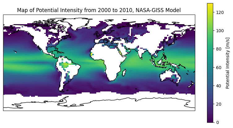
Simulating Tropical Cyclone Potential Intensity
December 2024Modeled how climate change influences hurricane intensity using CMIP6 data, creating a Python library for simulation and analysis.
Check out the repository for more details and installation instructions!
Python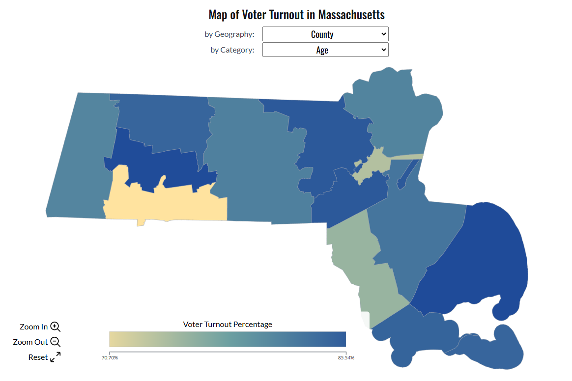
Voter Turnout and Demographics in Massachusetts
December 2024Integrated voter and Census data with ML models and interactive maps to uncover demographic drivers of turnout disparities.
Check out the interactive tool to dive deeper into the data!
Python D3.js
D3.js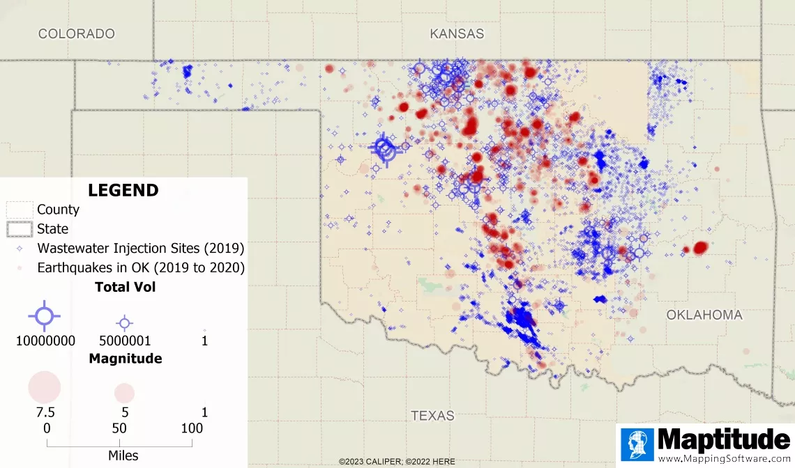
Analyzing Earthquakes with Mapping Software
August 2023Used Maptitude to explore earthquake patterns, uncovering links between seismic activity and wastewater injection sites in Oklahoma.
Check out the blog post to explore further insights!
 Maptitude
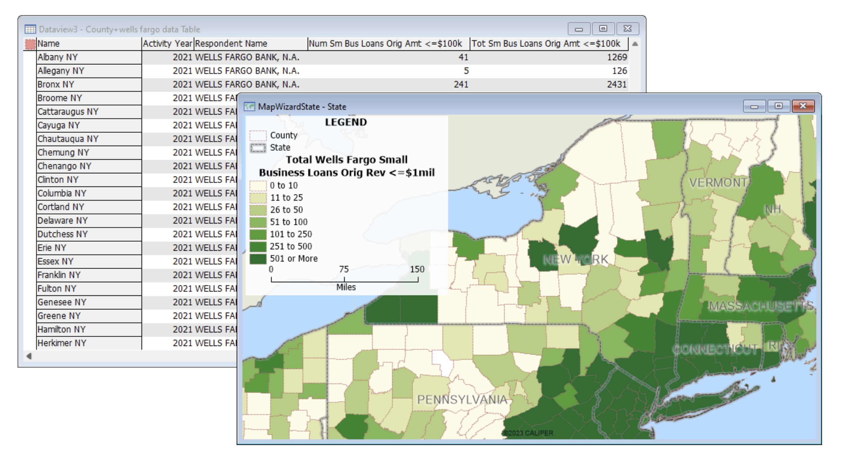
Maptitude Banking Compliance Data
June 2023Processed and streamlined regulatory datasets (CRA, HMDA, LAR) into analysis-ready geospatial layers for compliance and risk monitoring.
Check out the product description to get the full details!
PythonMaptitude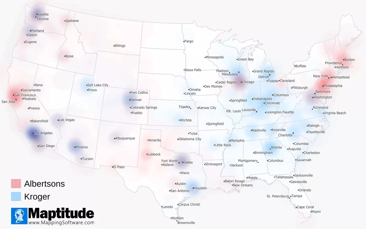
Albertsons and Kroger Geographic Market Analysis
October 2022Analyzed store overlaps and demographics to assess merger impacts, with results published in a blog recognized by the Financial Times.
Check out the blog post to get the full story!
Maptitude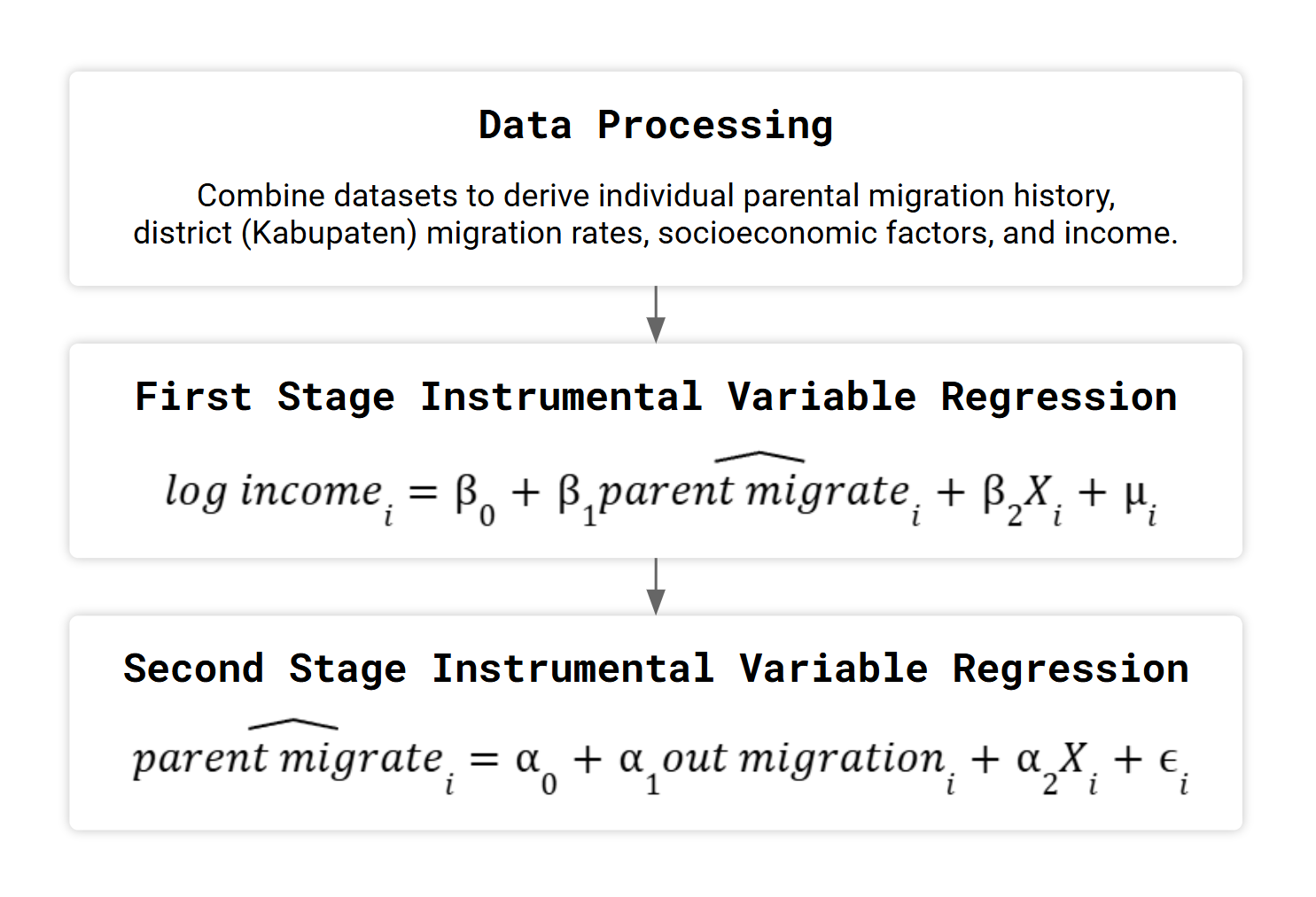
Long-term Effects of Parental Migration on Income: Evidence from Indonesia
May 2021Conducted an econometric study using 21 years of panel data (IFLS) to estimate the long-term impact of parental migration on child income.
Check out the full paper to review the complete findings!
 STATA
STATA